Whakatakotoranga Matua Ki Te Āpiti – Te Āpiti Manawatū Gorge Masterplan has been developed to protect the mana of Te Āpiti and enhance the experiences of those who visit here.
Kupu Whakataki
Introduction
Te Āpiti Manawatū Gorge is a taonga that for hundreds of years has been under the kaitiaki of Rangitāne o Manawatū, Rangitāne Tāmaki nui-ā-Rua, Ngāti Kahungunu ki Tāmaki nui-ā-Rua, and Ngāti Raukawa.
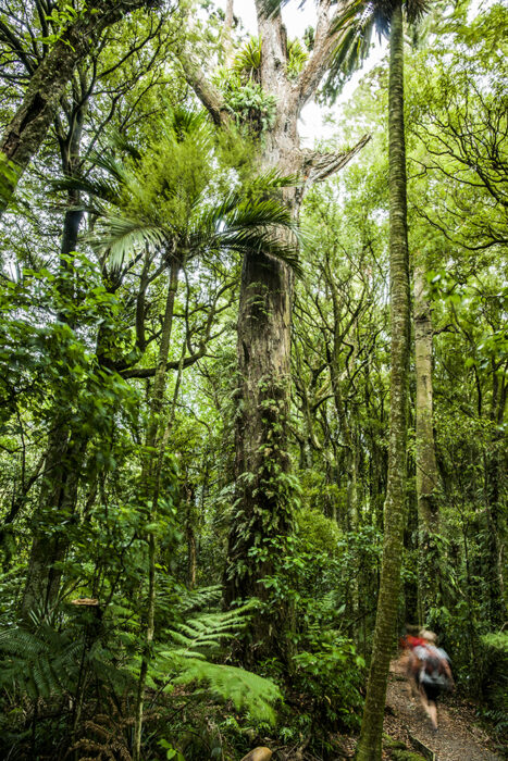
A place of great power and beauty, the diverse forest ecosystem of Te Āpiti Manawatū Gorge provides a home to many native birds and plants and is a favourite walking and cycling spot for locals and visitors alike.
Today, there are many parties that have a responsibility for managing parts of its large area. They are led by the overarching governance structure known as Te Āpiti Manawatū Gorge Governance Group.
Whakatakotoranga Matua Ki Te Āpiti (the Masterplan) provides a vision and strategic framework to protect, preserve and enhance the area so that all parties move in the same direction towards a common goal.
A full version of the Masterplan is available to download below. Please note that projects outlined in the masterplan and on the map below should be read as a guide only.
Why is a Masterplan needed?
The Masterplan sets the overall direction for Te Āpiti Manawatū Gorge for generations to come.
It takes into consideration a number of plans that already exist for the area, providing an overarching plan that unifies agencies with a common vision. It also aligns with the work already being done in the area. The Masterplan also sets out a number of key projects for consideration – many of which are underway already, others are more aspirational and yet to be confirmed.
Underpinning all significant projects is a commitment:
- To enhance the mana of Te Āpiti
- To protect and enhance biodiversity
- To improve recreational and visitor experiences
- To promote Te Āpiti as an ‘outdoor classroom’
Hinonga Mātuatua
Key projects
The Masterplan includes a number of proposed projects to be delivered for the area over time. These should be viewed as a guide only. More information will be added or updated as each project develops.
Alongside these proposed projects are two that are committed but had not yet been delivered at the time Te Āpiti Manawatū Gorge Governance Group adopted this Masterplan (May 2022). In addition, there are four existing key features in the area that are identified due to their overall importance and connection with other proposals.
Use the interactive map below to learn about these proposed and committed projects. Click on a project icon on the map, e.g P1, and a pop-up box will appear with the project details.
Key projects overview
Each project has a project lead and supporting agencies. Delivery timeframes range from short (1-5 years), medium (5-15 years) and long (15+ years). Click the thumbnail images for more detail on each project, or download the full Masterplan document.
Proposed projects
P1 | Proposed Ashhurst Loop Track
A 9km walking track connecting Ashhurst to the Manawatū Gorge, showcasing great views of two rivers and the ranges.
Project lead: Palmerston North City Council
Delivery term: Short

P2 | Proposed Visitor Facility and Accommodation Hub West
A purpose-built facility at the western gateway to the Manawatū Gorge.
Project lead: Shannon Family
Delivery term: Medium

P3 | Proposed Mountain Bike trail
An 11km grade 3-4 mountain bike trail running east-west across the southern side of the Manawatū Gorge Scenic Reserve.
Project lead: Manawatū Mountain Bike Club
Delivery term: Medium

A project raised by the Manawatū River Source to Sea group to promote and obtain UNESCO ‘Geopark’ status for Te Āpiti.
Project lead: Manawatū River Source to Sea
Delivery term: Long

P5 | Proposed Old Gorge Road shared path
A 9km shared path along the former roadway linking both sides of the ranges, with signage showcasing the unique cultural heritage of the area.
Project lead: TBC
Delivery term: Short

P6 | Proposed Barney’s Point Loop Track
An 8km walking track providing access near the eastern end of the old Gorge Road.
Project lead: TBC
Delivery term: Short

P7 | Proposed Skybridge Connecting Ranges
A suspension bridge (around 200m long) spanning the Manawatū River and providing stunning views and walking access between the Ruahine and Tararua Ranges.
Project lead: CEDA
Delivery term: Long

A 45km walking track extending along the Ruahine Ranges, from Wharite Peak north of Ashhurst through the Tararua Ranges to Arapuke Park south of Palmerston North.
Project lead: TBC
Delivery term: Medium

P9 | Proposed Suspension Bridge
A suspension bridge (around 180m long) crossing over the Manawatū River to provide safe walking access to and from the Ferry Reserve as part of the Lindauer Trail.
Project lead: Tararua District Council
Delivery term: Long

This 4km long shared path is named in honour of the famous artist Gottfried Lindauer who is buried in the Old Gorge Cemetery along the route.
Project lead: Tararua District Council
Delivery term: Short

P11 | Proposed Rangitāne Projects
A series of cultural projects developed by Rangitāne to showcase their unique history and deep connection to the awa and whenua.
Project lead: Iwi
Delivery term: Short/Medium/Long

Committed Projects
C1 | Ashhurst Bridge ‘Clip On’
A ‘clip on’ structure attached to the existing SH3 bridge over the Manawatū River.
Project lead: Waka Kotahi
Delivery term: Short

C2 | Te Ahu A Turanga Manawatū – Tararua Shared Path
A 12km long shared path following the path of the new Te Ahu a Turanga Manawatū – Tararua Highway. The path will eventually link up with existing and future tracks to provide a full loop around the gorge.
Project lead: Waka Kotahi
Delivery term: Short

Existing Projects
The popular Manawatū Gorge Track is just over 11km long and offers stunning views of the gorge and beyond.
Project lead: DOC
Delivery: Existing

E2 | Te Āpiti Manawatū Gorge Unfenced Sanctuary
A biodiversity taonga, the Te Āpiti Manawatū Gorge has benefited from years of collaborative weed and pest animal control efforts.
Project lead: TAMGGG
Delivery: Existing (Sanctuary component = Medium)

E3 | Te Ara o Mahurangi Mountain Bike Trail
This 3.6km dedicated mountain bike track with a 2km downhill section is located on Hall Block Road on the eastern side of the Manawatū Gorge.
Project lead: Manawatū Mountain Bike Club
Delivery: Existing

E4 | Visitor and Accommodation Hub East
Centred at the popular Te Waha o Te Kurī (Ferry Reserve), this beautiful 24ha reserve provides large flat areas, freedom camping and easy access to the Manawatū River.
Project lead: Woodville Domain Board
Delivery: Existing
