Masterplan
Whakatakotoranga Matua Ki Te Āpiti (the Masterplan) sets out a shared vision and strategic framework to protect, preserve and enhance Te Āpiti. It helps ensure all parties are working towards the same long-term goals for the Gorge and its surrounding landscape.

The Masterplan provides a long-term direction for Te Āpiti Manawatū Gorge, helping to shape its future for generations to come.
It brings together existing plans and initiatives, creating a shared vision that aligns the work of agencies and organisations across the area. It also recognises the projects already underway and identifies future opportunities for consideration.
At the heart of all significant projects is a commitment to:
Enhance the mana of Te Āpiti Manawatū
Protect and enhance biodiversity
Improve recreational and visitor experiences
Promote Te Āpiti as an outdoor classroom
Masterplan Development Projects - UNDERWAY / IN PLANNING
Ashhurst Loop Track
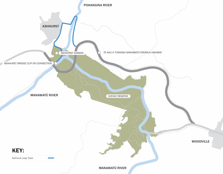
A 9km long loop walking track connecting Ashhurst township to the Manawatū Gorge and showcasing great views of two rivers and the ranges. The track passes over the Manawatū and Pohangina Rivers and will utilise the shared path from the Western Gateway Park at the western end of the gorge to the Ashhurst Domain.
Update:
The eastern section (true left bank) of then loop track, from the Ashhurst Saddle Road Bridge to the Tu Ahu a Turanga - Manawatū Tararua Highway and its western walking tracks and shared path, was created by NZTA as a construction haul road for the Highway construction and has been converted to recreation use.
NZTA are constructing a pedestrian and cycle bridge across then Manawatu River next to, and on the downstream side of, the existing road bridge. NZTA will connect that bridge back up to the Ashhurst Domain and through to the sportsfield carpark Cambridge Ave. Construction is planned to begin in 2027.
Palmerston North City Council is creating a formed path from Mulgrave Street through to McCraes Bush in 2026/2027 including reinstating a ramp access from the top of the Terrace to the lower area to make it more accessible to horse riders and cyclists. PNCC is also investigating what changes could be made to the Ashhurst Saddle Road bridge and its approaches to make the full loop available.
UNESCO Geopark
A project raised by the Manawatū River Source to Sea group to promote and obtain UNESCO ‘Geopark’ status for Te Āpiti. If awarded the status would provide an additional layer of protection along with recognition on the international stage. This would have benefits for regional pride as well as increasing visitor numbers to the region.
Update: A geopark is being established with signage and information for visitors (See the Geology and Formation page) with the aim of one day seeking UNESCO status for this.
Lindauer Trail
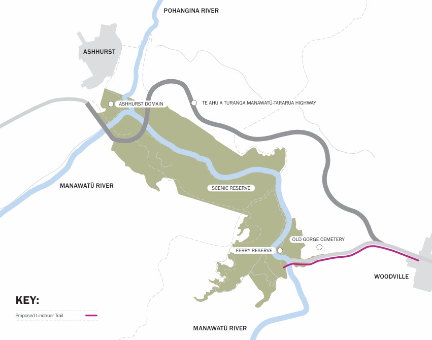
A 4km long shared path connecting Woodville to the Ferry Reserve on the eastern side of the Manawatū Gorge. The trail would also provide for a full 35km walking loop around both sides of the gorge by connecting the eastern end up. The trail is named in honour of the famous artist Gottfried Lindauer who was buried in 1926 in the Old Gorge Cemetery which is along the route. The trail would include interpretive signage celebrating the life of Lindauer.
Update: A portion of the trail has already been constructed to Hampson Street on the western outskirts of Woodville.