The History of transport through the Gorge
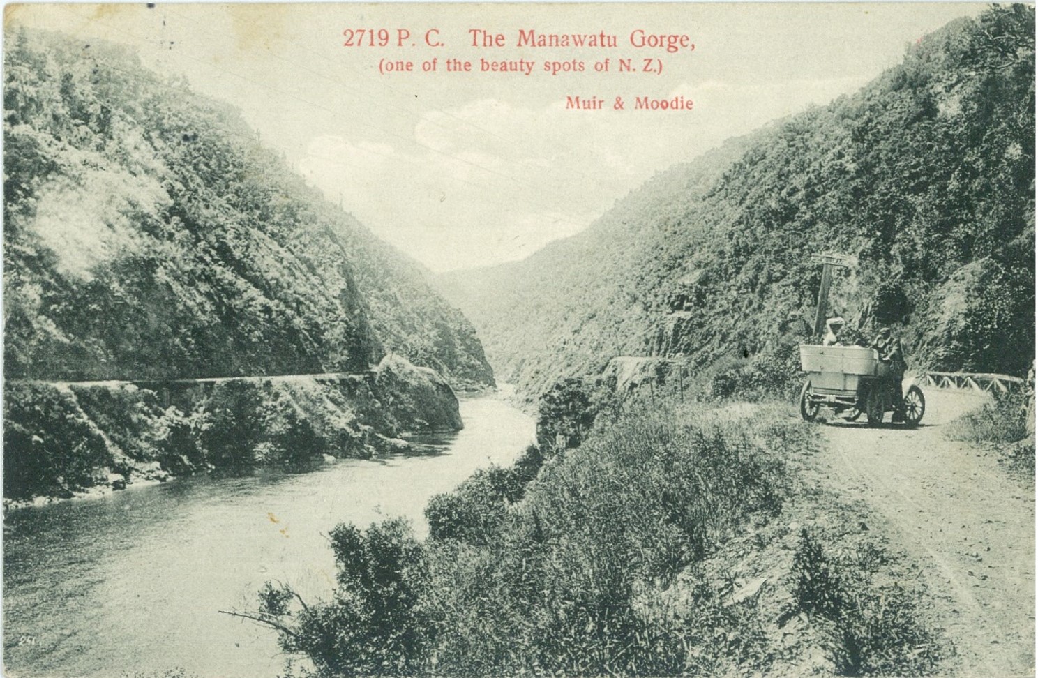
The name Te Āpiti, meaning "the narrow passage", was given to the Manawatū Gorge by Rangitāne, the tangata whenua of this area.
For more than 700 years, Te Āpiti served as an important connection between the eastern and western parts of the Rangitāne rohe. Long before roads were built through the gorge, local Māori travelled along the Manawatū River, hauling their waka upstream through its rapids.
The river was known as Te Au Rere a Te Tonga, meaning "the rushing current of the south". This name reflects the power and significance of this important waterway.
(Image is an old postcard from the early 1900s)
The Closure of the Manawatu Gorge Road
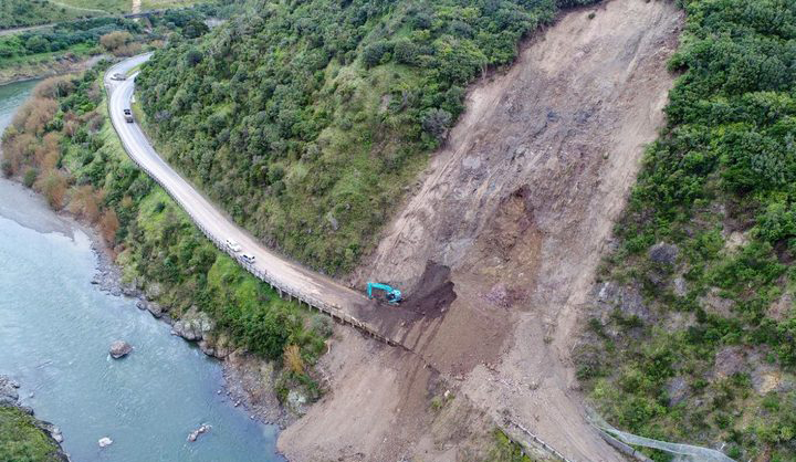
In 2017, the section of State Highway 3 (SH3) through Te Āpiti – Manawatū Gorge was permanently closed following a series of significant slips. Geotechnical assessments undertaken by NZ Transport Agency Waka Kotahi determined that the road was no longer safe for public use.
Since the closure, further slips and rockfalls have occurred along the former road corridor, reinforcing the ongoing instability of the surrounding hillside.
The road remains permanently closed to all public access, including pedestrians, cyclists and motorists. Due to the risk of slips, rockfalls and other potentially life-threatening hazards, access to the area is strictly prohibited.
The risks are considered unacceptable for anyone stopping for any length of time within the corridor. This affects all activities such as walking, cycling, sightseeing, or workers who may need to carry out pest control or assess existing structures and infrastructure. The unstable terrain and ongoing risk of rockfall make the area too unsafe to access.
Please do not enter the closed road corridor under any circumstances.
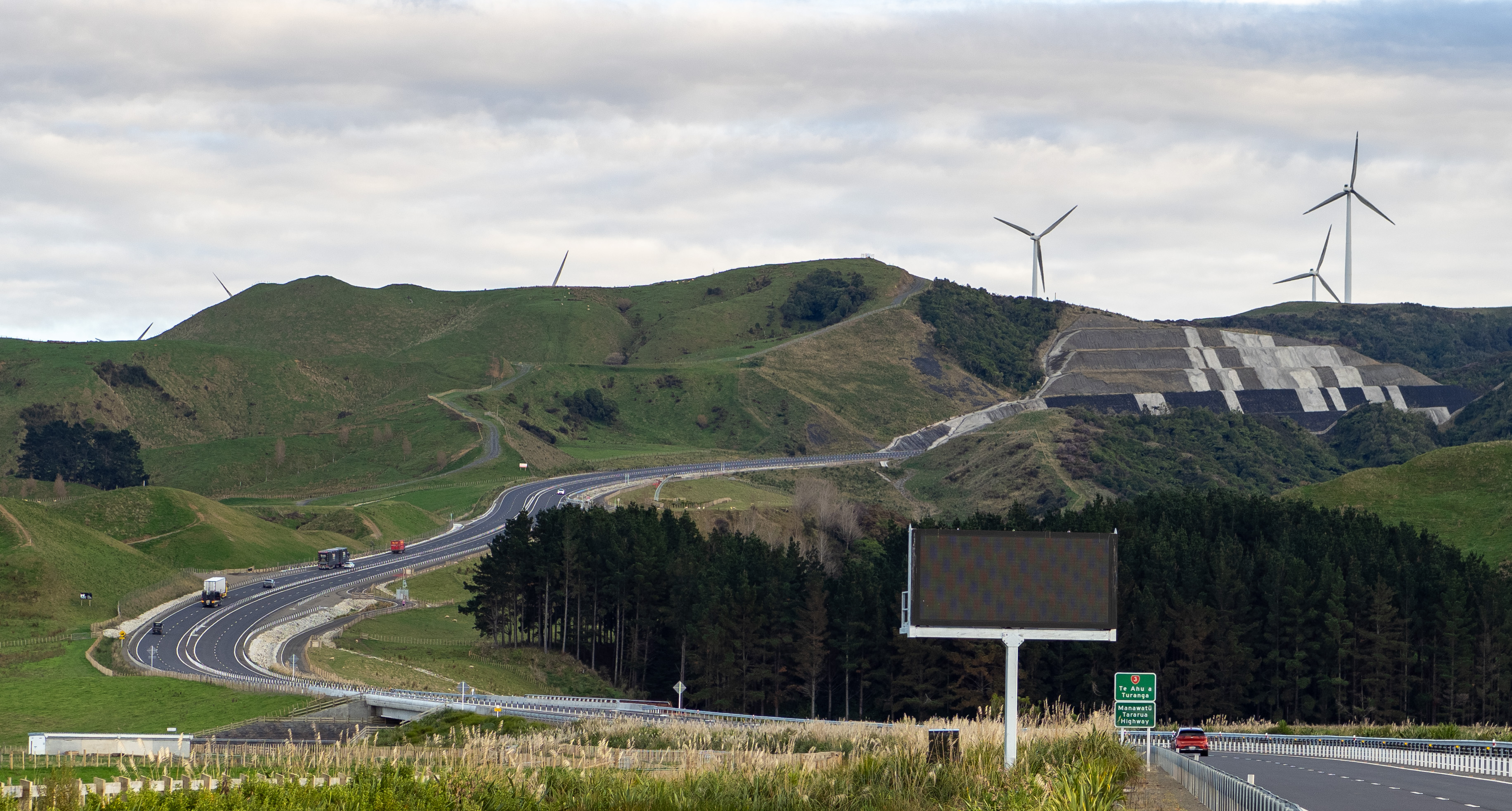
The former SH3 route through the gorge has been replaced by Te Ahu a Turanga: Manawatū Tararua Highway.
Manawatū Tararua Highway Te Ahu a Turanga
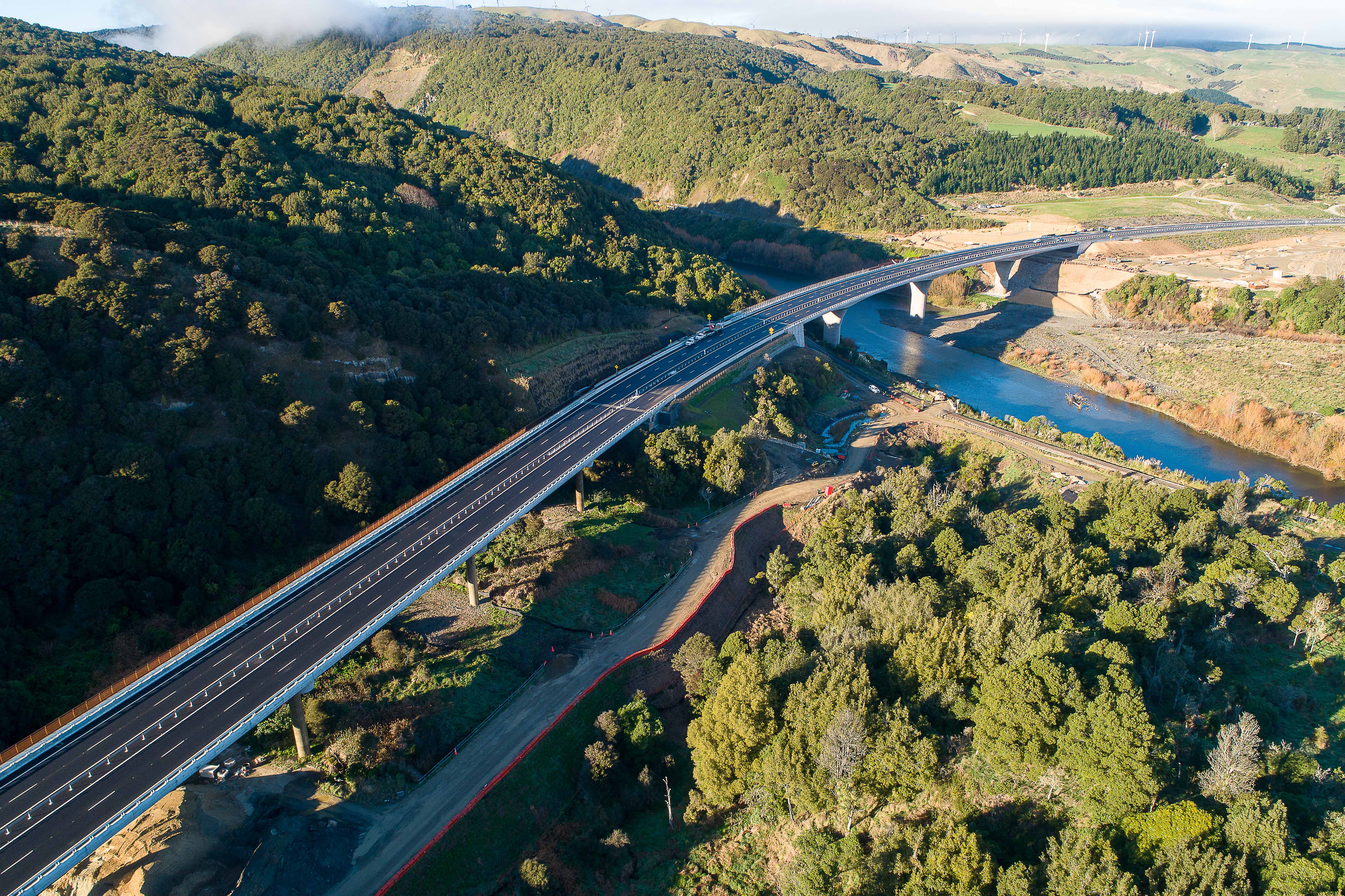
Te Ahu a Turanga: Manawatū Tararua Highway offers a new way to experience the landscapes, stories and views that make Te Āpiti unique.
Opened in 2025, the highway replaced the former route through the Manawatū Gorge, which was closed in 2017 following a series of major landslips. The project involved more than 6.5 million cubic metres of earthworks and the planting of more than 1.8 million trees and plants, making it one of the region's most significant infrastructure projects.
Two of the most striking features along the route are the 300-metre-long Parahaki Bridge and the neighbouring Eco-Viaduct. The Parahaki Bridge spans the Manawatū River and provides access to a lookout featuring mahi toi and interpretation panels that share the stories of the surrounding landscape.
Just to the north, the Eco-Viaduct crosses an ecologically sensitive wetland, helping to protect and enhance an important natural environment that has become a public amenity. The former construction site and access tracks have been converted into new walking trails and a beautifully landscaped wetland experience.
Alongside the highway is the Te Ahu a Turanga Shared User Path, offering walkers and cyclists opportunities to explore the area from a different perspective. As the route crosses the ranges, it reveals sweeping views of the Ruahine and Tararua Ranges, the Manawatū River and the wider Te Āpiti landscape.
At the western end of the highway, a new park provides car parking and toilet facilities, enabling access to the Shared User Path and Te Āpiti - Manawatū Gorge tracks.
The highway has also opened up new walking and cycling opportunities, with tracks, lookouts and connections continuing to develop around the corridor. Whether you're travelling through, exploring on foot or enjoying the shared pathway, Te Ahu a Turanga offers a new perspective on one of the region's most remarkable landscapes.
Alongside the highway is the Te Ahu a Turanga Shared User Path, offering walkers and cyclists opportunities to explore the area from a different perspective. As the route crosses the ranges, it reveals sweeping views of the Ruahine and Tararua Ranges, the Manawatū River and the wider Te Āpiti landscape.
At the western end of the highway, a new park provides car parking and toilet facilities, enabling access to the Shared User Path and Te Āpiti Manawatū.
The highway has also opened up new walking and cycling opportunities, with tracks, lookouts and connections continuing to develop around the corridor. Whether you're travelling through, exploring on foot or enjoying the shared pathway, Te Ahu a Turanga offers a new perspective on one of the region's most remarkable landscapes.
Images courtesy of NZTA